
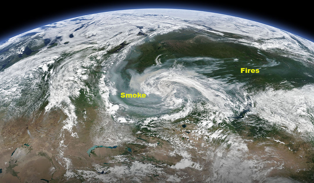
Forest fires in Siberia are bringing even more misery to an area already closed off because of the coronavirus pandemic.
NASA’s satellite photos are often the first to detect forest fires in remote regions. The locations of new fires will then be sent directly to local authorities within a few hours of the satellite crossing. Together, NASA’s instruments actively detect burning fires, track the smoke transport of fires, provide fire management information, and map the extent of ecosystem changes based on the scale and severity of fire scars. NASA has several global observation satellites, many of which contribute to our understanding of fires in the global system. Satellites orbiting the poles provide observations of the entire planet several times a day, while satellites in a geostationary orbit provide images of fires, smoke and clouds in rough resolution every five to 15 minutes.

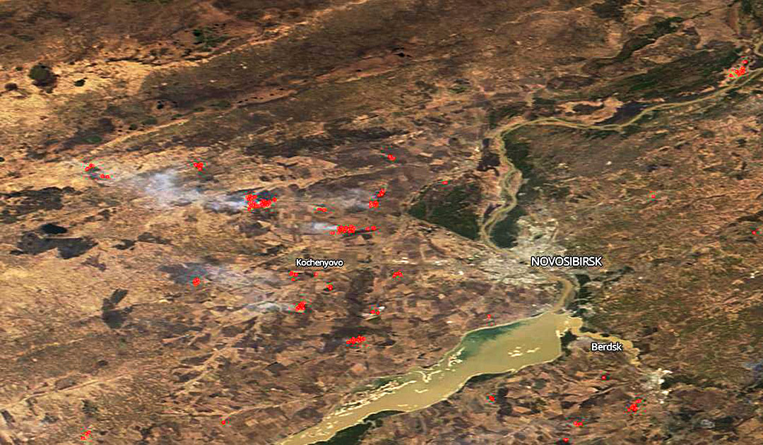
NASA’s Earth Observing System Data and Information System (EOSDIS) Worldview application provides the ability to interactively search over 700 global satellite image layers in full resolution and then download the underlying data. Many of the available image layers are updated within three hours of observation, essentially showing the entire Earth as it looks “just now.” Actively burning fires detected by thermal bands are represented as red dots. At some of the red dots, smoke may rise from them, indicating a fire.
Heiner Kubny, PolarJournal


