
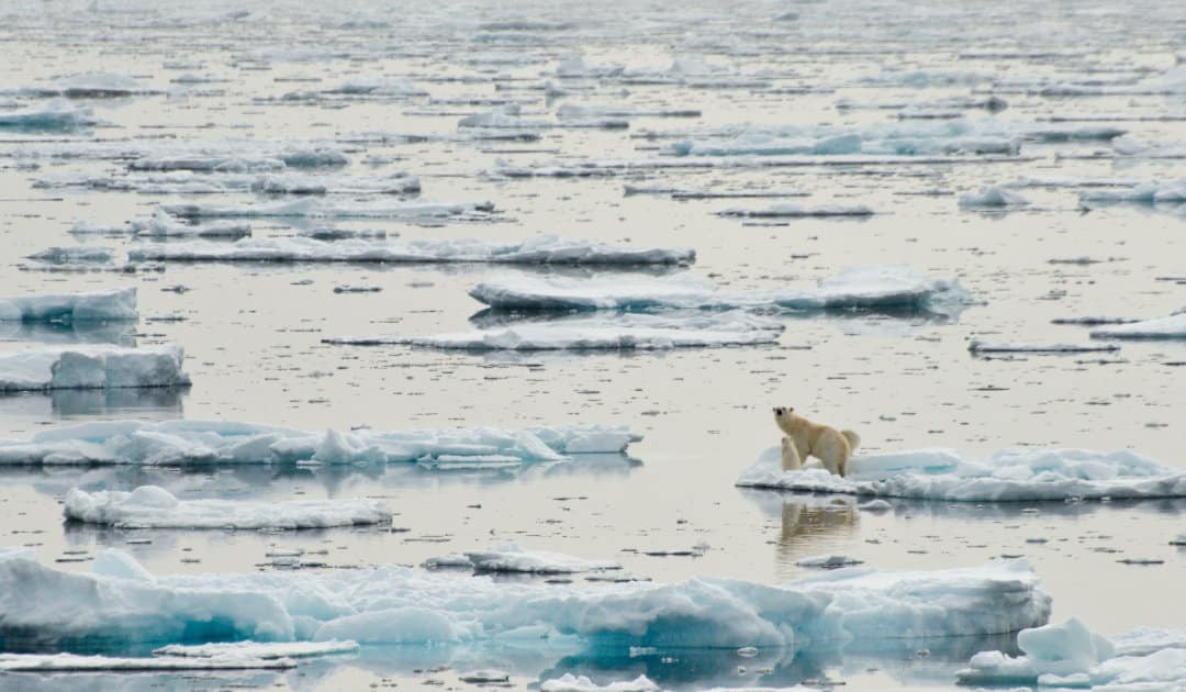
Spring in Europe is full of extremes this year. The cold spells with snow even at low altitudes in the middle of April were particularly hard on agriculture. But this is not the first time we have experienced such conditions. Such weather extremes have been occurring more frequently over the years. The loss of Arctic sea ice is likely responsible, says an international research team in a just-published study.
The result of the study, which was published in the renowned journal Nature Geoscience, actually sounds paradoxical: Due to the warmer climate, it has snowed more in Europe in the spring. But what sounds like grist to the climate change sceptics’ mill makes a lot of sense on closer inspection. This is because the research group, led by Professor Jeffrey M. Welker of the University of Oulu (Finland) and University of Alaska Anchorage, was able to show that more water was able to evaporate in 2018 due to the disappearance of sea ice and the resulting larger open water area in the Barents Sea. This water vapour subsequently fell as snow in central Europe and provided the unusual amounts of snow, dubbed “The Beast from the East” by the media at the time along with the cold snap. According to the results of the study, about 88 percent of the snow came from the Barents region, and it is likely to increase as sea ice continues to be lost there. By 60 years from now, the research group says, the ice-free Barents Sea will be the main contributor to winter precipitation in Europe.

For their results, the research group used the unique geochemical fingerprint of snow and water vapor produced by isotopes. For this purpose, samples from the Finnish north were analysed and compared with meteorological and oceanographic data. They were able to determine the source of the snowfall and show that most of it came from the Barents Sea. This region also experiences the greatest loss of Arctic sea ice in March since satellite records began. According to the researchers’ calculations, 140 gigatons of moisture entered the atmosphere between February and March 2018 because there was no sea ice over the ocean. A specific weather situation with high temperatures over the Arctic provided the water vapour and a weakening of the Arctic polar vortex brought this moisture together with the cold as snow to northern and central Europe. According to the study, it was just under 160 gigatons of snow. Similar conditions prevailed this year, bringing the corresponding snow and cold chaos far into central Europe. The fact that the loss of Arctic sea ice is causing more water vapor in the atmosphere is not new. But this study was the first to show a direct link between these moisture masses and snowfall in Europe, and also to determine them in terms of quantity and timing.

“Nature is complex and what happens in the Arctic doesn’t stay in the Arctic.”
Dr. Hanna Bailex, lead author of the study, University of Oulu
The sea ice that normally covers the Arctic Ocean has declined sharply in recent decades. In the Barents region, the figure is around 56 percent since satellite measurements began. Perennial ice, in particular, is scarce throughout the Arctic Ocean. Further, according to experts, 95 percent of the sea ice lost in March since 1979 is attributable to this region. As a result, the Arctic Ocean is warming up more and more and the water is transporting this heat also under the sea ice in other regions and as a deep current back to the southern hemisphere. “What we’re finding is that sea-ice is effectively a lid on the ocean,” explains Dr. Hanna Bailey of the University of Oulu and lead author of the study. “And with its long-term reduction across the Arctic, we’re seeing increasing amounts of moisture enter the atmosphere during winter, which directly impacts our weather further south, causing extreme heavy snowfalls. It might seem counter-intuitive, but nature is complex and what happens in the Arctic doesn’t stay in the Arctic.”
Research leader Professor Jeffrey Welker agrees: “This study depicts and traces how sea ice loss has cascading consequences to the Arctic water cycle with dramatic effects on landscapes and societies in mid-latitude regions.” And these consequences are likely to increase in the coming decades. This is because the team concludes that as sea ice continues to retreat, more and more water vapour will accumulate in the atmosphere in winter/spring and, together with more frequent weakening of the polar vortex over the Arctic, will cause more precipitation in central Europe, but only in the far north as snow, as temperatures here remain sufficiently low. For the inhabitants of Central Europe, on the other hand, this could mean more rain in winter.
Dr Michael Wenger, PolarJournal
Link to the study: Bailey, H., Hubbard, A., Klein, E.S. et al. Arctic sea-ice loss fuels extreme European snowfall. Nat. Geosci. (2021). https://doi.org/10.1038/s41561-021-00719-y
More on the subject:


