
A team of MIT engineers has developed a navigation method for autonomous vehicles that allows them to navigate accurately in the Arctic Ocean without GPS. Mary Beth Gallagher of the Mechanical Engineering Department reported this in a press release.
Beneath the vast, lonely expanses of ice and snow in the Arctic, there is much activity. Climate change has dramatically altered the ice sheet that covers much of the Arctic Ocean. Water areas that used to be covered by a solid layer of egg are now covered by thin layers that are only a meter thick. Beneath the ice, a warm water layer that is part of the Beaufort lens has changed the composition of the aquatic environment. For scientists to understand the role this changing environment in the Arctic Ocean plays in global climate change, the ocean beneath the ice sheet must be mapped.

A team of MIT engineers and naval officers, led by Henrik Schmidt, professor of mechanical and ocean engineering, have been trying to understand environmental changes, their impact on subsurface acoustic transmission, and how these changes affect vehicle navigation and communication under the ice.
“Basically, we want to understand how this new Arctic environment caused by global climate change affects the use of underwater sound for communication, navigation and perception,” Schmidt explains.
To answer this question, Schmidt traveled to the Arctic with some members of the Laboratory for Autonomous Marine Sensor Systems (LAMSS). Joining them were graduate students Daniel Goodwin and Bradli Howard, of the MIT-Woods Hole Oceanographic Institution’s joint program in oceanographic engineering.
With funding from the Office of Naval Research, the team participated in ICEX 2000 and Ice Exercise 2020, a three-week U.S. Navy program in which military personnel, scientists, and engineers worked side-by-side on research projects and missions, performing a variety of tasks.

A strategic waterway
The rapidly changing environment in the Arctic has far-reaching implications. The thinning ice could not only give researchers more information about the effects of global warming and the impact on marine mammals, but also potentially open up new shipping lanes and trade routes in areas that were previously impassable.
Perhaps most importantly for the U.S. Navy, understanding the changing environment also has geopolitical significance.
“If the Arctic environment changes and we don’t understand it, it could have national security implications,” Goodwin says.
A few years ago, Schmidt and his colleague Arthur Baggeroer, a professor of mechanical and ocean engineering, were among the first to realize that the warmer water that is part of the Beaufort lens, along with the changing ice composition, affected the sound waves in the water.
To successfully navigate through the Arctic, the U.S. Navy and other entities in the region need to understand how these changes in sound propagation affect a vehicle’s ability to communicate and navigate through the water.
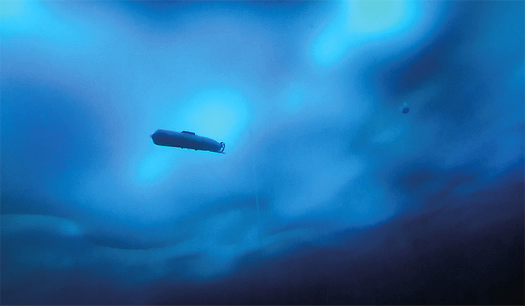
Schmidt and his team are using a non-piloted autonomous underwater vehicle (AUV) built by General Dynamics-Mission Systems (GD-MS) and a system of sensors attached to buoys developed by Woods Hole Oceanographic Institution. Together with Dan McDonald and Josiah DeLange from GD-MS, she wanted to demonstrate a new integrated acoustic communication and navigation concept.
“To prove that you can use this navigation concept in the Arctic, we first need to make sure we fully understand the environment we’re operating in,” Goodwin adds.
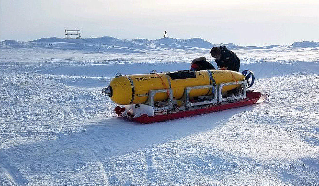
After arriving at the camp on the ice at the Arctic Submarine Lab last spring, the research team deployed a series of conductivity, temperature and depth probes to collect data on the aquatic environment in the Arctic.
“By using temperature and salinity as a function of depth, we calculate the sound speed profile. This helps us understand whether the AUV’s location is good or bad for communications,” says Howard, who was responsible for monitoring environmental changes at the water column throughout ICEX.
Because of the way sound bends in water, sinusoidal pressure waves accumulate, which is known as Snell’s Law. Understanding the propagation patterns is key to predicting good and bad sites for AUV operation.
To map the areas of water with optimal acoustic properties, Howard modified the traditional signal-to-noise ratio (SNR) using a metric called the multi-path penalty (MPP), which screens out areas where the AUV receives echoes. As a result, the vehicle prioritizes operations in areas with less reverberation.
With this data, the team was able to identify exactly where the vehicle should be positioned in the water column to ensure optimal communication leading to accurate navigation.
While Howard collected data on how the properties of water affect acoustics, Goodwin focused on how sound is projected and reflected from the ever-changing ice on the surface.
To obtain this data, the AUV was equipped with a device that measures the movement of the vehicle to the overlying ice. This sound was picked up by several receivers attached under the ice.
The data from the vehicle and the receivers were then used by the researchers to calculate exactly where the vehicle was at any given time. This location information, along with data Howard has collected on the acoustic environment in the water, provides a new navigation concept for vehicles traveling in the Arctic.
Source: Mary Beth Gallagher, Department of Mechanical Engineering


