
Scientists are more frequently using satellite imagery to monitor and count animal populations in remote regions. Just recently, a study was published on the first complete inventory of Weddell seals with the help of citizen scientists who counted the animals on satellite images. Now, the British Antarctic Survey and WWF launched a new project, “Walrus from Space,” calling on citizen scientists to help count Atlantic walruses and walruses in the Laptev Sea. The results will provide more information on the impact of the climate crisis on walruses.
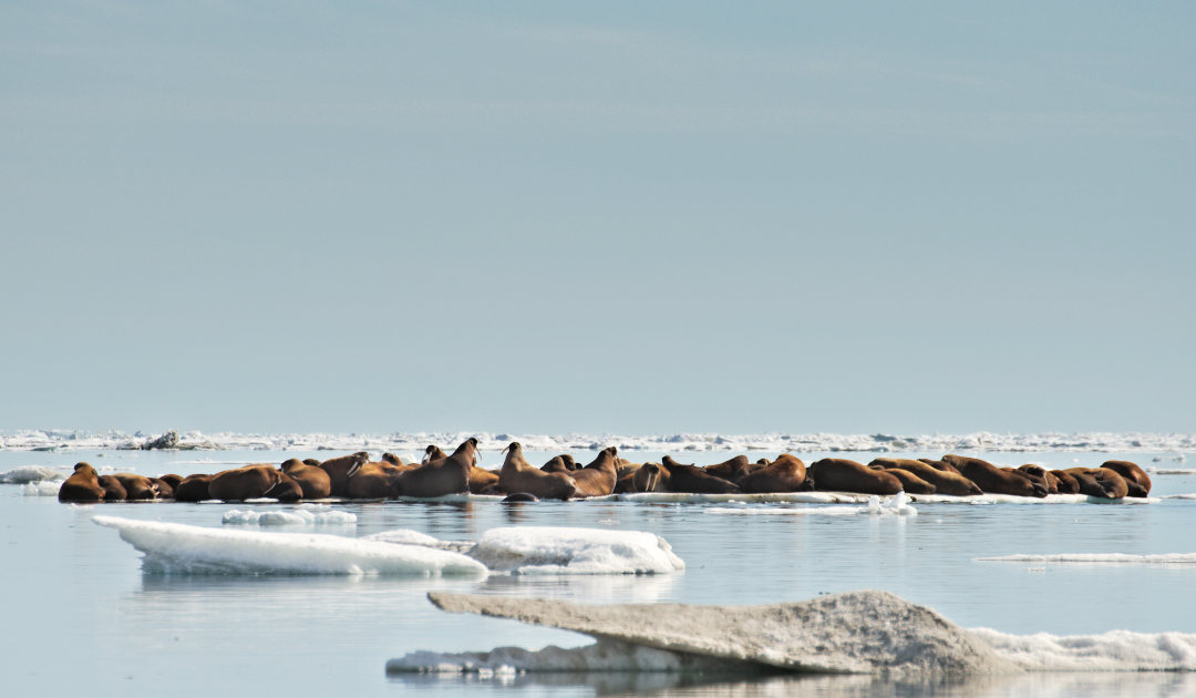
Walruses are already particularly threatened by climate change: Due to the strong warming in the Arctic – almost three times faster than in the rest of the world – they are losing their habitat. Summer sea ice, their resting place and nursery, is melting away under their flippers (by 13 percent per decade), and they need to swim long distances more often to reach beaches where they can rest. They may then have to expend more energy searching for food because they have to swim farther.
The haulouts are used by so many individuals that they are often completely crowded. Walruses are very skittish and, when frightened, push towards the water, trampling each other in their panic.
To secure the future of the iconic Arctic creatures, greater knowledge about them is essential. That’s why the British Antarctic Survey and WWF are working to better understand walruses by using satellite imagery to count their populations over an area of more than 25,000 square kilometers along the Arctic coastline. The imagery for the project is being provided by space and intelligence company Maxar Technologies’ DigitalGlobe.
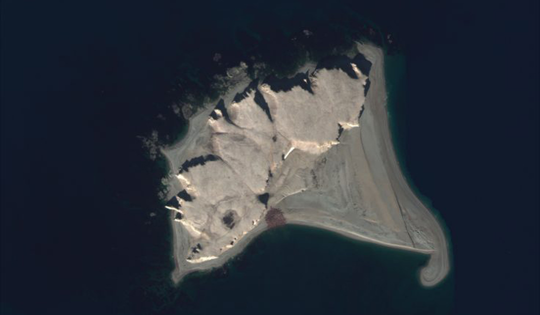
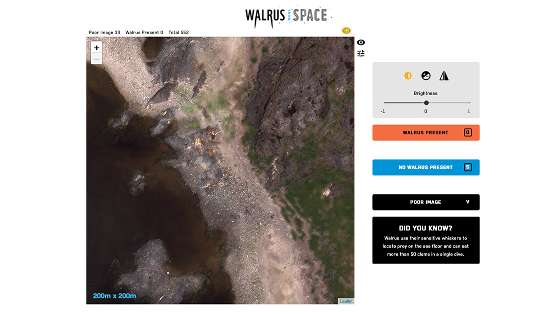
This is another project in which scientists are asking citizens for help. Volunteers from around the world can view the satellite images from the comfort of their own homes, locate areas where walruses come ashore, and then count them. Using the population numbers, scientists can determine how individual populations are doing, without disturbing the animals. The data will also inform management decisions to ensure the conservation of the species.
The vanishing sea ice not only deprives walruses of their habitat, but also makes the Arctic more accessible to shipping and industrial projects, which means the animals face more disturbance.
Hannah Cubaynes, wildlife from space research associate at British Antarctic Survey, says: “Assessing walrus populations by traditional methods is very difficult as they live in extremely remote areas, spend much of their time on the sea ice and move around a lot, Satellite images can solve this problem as they can survey huge tracts of coastline to assess where walrus are and help us count the ones that we find. However, doing that for all the Atlantic and Laptev walrus will take huge amounts of imagery, much too much for a single scientist or small team, so we need help from thousands of citizen scientists to help us learn more about this iconic animal.”
Rod Downie, chief polar advisor at WWF, added: “Walrus are an iconic species of great cultural significance to the people of the Arctic, but climate change is melting their icy home. It’s easy to feel powerless in the face of the climate and nature emergency, but this project enables individuals to take action to understand a species threatened by the climate crisis, and to help to safeguard their future. What happens in the Arctic doesn’t stay there; the climate crisis is a global problem, bigger than any person, species or region. Ahead of hosting this year’s global climate summit, the UK must raise its ambition and keep all of its climate promises – for the sake of the walrus, and the world.”
Earlier this year, Scouts from across the UK trialed the study platform before it was released. After helping out, Girl Scout Imogen Scullard, 9, says: “I love learning about the planet and how it works. We need to protect it from climate change. We are helping the planet by doing the walrus count with space satellites, which is really cool. It was a hard thing to do but we stuck at it.”
Project partners BAS and WWF hope that “Walrus from Space” will recruit more than 500,000 citizen scientists to participate in the census over the next five years. The project is supported by People’s Postcode Lottery players, RBC Tech For Nature and WWF supporters.
Julia Hager, PolarJournal
More on the subject:


