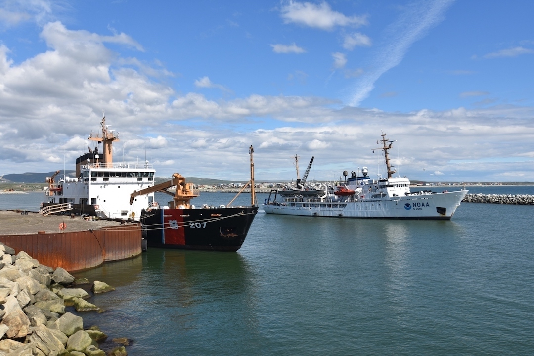
Among the 125 ports that service Alaska’s mind-boggling 70,000km of coastline, just four are considered deepwater ports. None of them are found on the portion that lies in the state’s — that is to say America’s — “maritime Arctic”. One of the consequences of this is that when the country’s three big icebreakers operate there, the nearest port they can call on on is Dutch Harbor, in the Aleutian Islands, almost 3,000km from the state’s northern coast, a journey of about a week. When they aren’t operating, home is Seattle, on the Pacific coast. Now, an almost two-decade push to create the America’s first deepwater Arctic port appears to be about to cross the finish line.
Making America’s Arctic accessible to not just icebreakers, but also cargo vessels, cruise liners and research ships, say proponents, will make the country and the state safer and wealthier and wiser about its maritime environment. The idea of not just one but several Arctic deepwater ports enjoys widespread support, but it has taken years to sort out just how many of them should be built, where to place them, and, not least, where the money would come from.
In 2015, the Army Corps of Engineers, a federal agency responsible for managing the nation’s waterways, cleared up at least one of those questions when it identified Nome as the place to start. In 2020, it approved the city’s proposed design for the enlarged port (pictured at top of article), and, finally, on 21 December, Congress answered a second question when it said it would kick in $250 million (€220 million), or about half of the project’s expected cost. The rest will come from local and, Nome officials hope, state, sources.

The plan approved by the Army Corps of Engineers would double the length of one of the port’s two existing causeways. The second would be demolished and a longer one built in its place, greatly increasing the area of its inner harbour. The work would also involve dredging a deeper entrance channel and establishing docking areas in the outer harbour where the depth will be 13 metres. The final adjustments to the design are expected to take two years.
Where to build the next port, and what purpose it would serve, are a subject of further discussion. The Army Corps of Engineers was tasked with finding a location to build a single multi-purpose port, but the brief it was working from made it clear it was intended to be the first of a larger system of port facilities in the Arctic and sub-Arctic (the area marked in yellow in the map below). Fourteen sites were given an initial look; three were given close consideration. A fourth, a seasonal coast-guard base at Port Clarence, is talked up as a possible candidate to become a year-round coast-guard facility, in part because it has an airstrip, and because of its proximity to Russia. That is a card the state’s lawmakers in Washington frequently play, but the coastguard, for its part, has said its money is better spent on building capacity (in the form of six heavy icebreakers) than on ports right now. It has also said it would like those icebreakers to be stationed in Alaska, however. The ports cometh, but the icebreakers are likely get there first.

Kevin McGwin, PolarJournal
More about this topic


