

The marine protected area around South Georgia and the South Sandwich Islands is one of the largest in the world. It was established in 2012 to protect and conserve the rich marine wildlife in the region, including whales, seals, penguins and other seabirds, as well as their prey (fish and krill). Now, the British Antarctic Survey, together with the government of South Georgia and the South Sandwich Islands, has released a new data portal to help manage the marine protected area.
The new, open-access data portal contains comprehensive up-to-date information on ecology, environmental conditions, and human activities that is particularly relevant to managers, scientists, and stakeholders. For example, in addition to general information on the species, the respective statistics on breeding success or populations as well as maps showing the breeding colonies can be retrieved from the various seabird species. Similar data exist for the seals and penguins. For some species, even satellite data of their migrations are available.
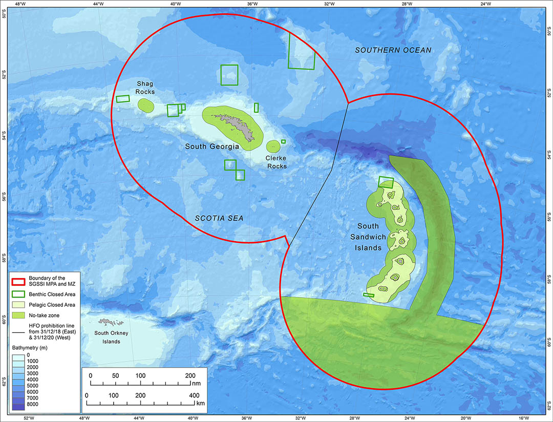
Information is also available on bathymetry, currents, sea ice extent, and ocean surface temperature.
In total, the data portal contains over 150 interactive maps and data summaries linked directly to the online South Georgia GIS and the UK Polar Data Centre’s Discovery Metadata System. The portal is part of the project “Building Data Resources for SGSSI Marine Protected Area Management” undertaken by the British Antarctic Survey and the UK Polar Data Centre in collaboration with the Government of South Georgia and the South Sandwich Islands.
“The new Data Portal highlights the enormous amount of scientific information and research effort that contributed to the designation of the MPA, and which continues to advance our understanding of the ecosystem and to ensure that it is protected into the future,” said Dr. Susie Grant, marine biogeographer at the British Antarctic Survey and leader of the project.
Jonathan Handley, Project Manager of the Marine Programme at BirdLife International adds, “It’s excellent to see this new Data Portal now live and available to stakeholders. It is an essential tool that has greatly contributed to the BirdLife International Marine Programmes’ ability to support identifying and monitoring a global network of important sites for bird species.”
In addition to the diverse information, the data portal also includes a research and monitoring plan for the Marine Protected Area to guide future scientific activities that will contribute to a better understanding of the marine ecosystem, assess the nature and extent of future changes, and provide information to evaluate the effectiveness of the marine protected area.
The MPA is reviewed every five years to ensure that protective measures continue to be effective and that the most current scientific knowledge is taken into account.
Julia Hager, PolarJournal / Original text: British Antarctic Survey
Link to Data Portal: South Georgia and South Sandwich Islands MPA Data Portal
More on the subject:


