

The size of the polar regions poses a major problem for science when it comes to recording the effects of climatic changes. Therefore, the view from above is relied on satellites, which observe and measure the millions of square kilometers of sea ice, glaciers and ice sheets with their measuring instruments from an altitude of hundreds of kilometers. One of the newest and meanwhile most successful satellites is ICESat2, which has received the green light from NASA to continue its mission after its primary phase of more than 3 years.
Scientists around the world agree that the 1.5-ton, 2.5×1.9×3.8-meter satellite has become a groundbreaking and enormously important tool for remote sensing. Since its launch on September 15, 2018, the satellite has been orbiting Earth at an altitude of about 490 kilometers, firing its six laser beams from the ATLAS (Advanced Topographic Laser Altimeter System) measurement instrument. The quantities of measurements are gigantic: more than 12 trillion height measurements have been recorded since commissioning. That’s because the laser fires 10,000 pulses of light per beam per second, every day without interruption. “I’m truly amazed at the engineering of ICESat-2. We’re counting individual photons bouncing off the surface of Earth – with incredible precision. And the science that is flowing from it is incredible,” says Alex Gardner of NASA’s Jet Propulsion Lab. And that’s why NASA has now given the green light to extend the mission, which was originally designed to last three years. “ICESat-2 has gone beyond what it was designed for. I’m looking forward to extending the time series to get monthly data of polar regions over the years – something we haven’t had” explains Thorsten Markus, cryosphere program manager at NASA.
The impact that satellite data has had on science since 2018 can hardly be overstated by NASA and other researchers. Thanks to the data from ICESat-2, for example, it has been possible to show that the Arctic sea ice has not only become smaller in extent, but has also lost volume, i.e. thickness, since 2003. Neither clouds nor melt ponds interfere with the accuracy of the measurements, since the laser instrument is a LIDAR system (Light Detection and Ranging), the lasers emit light with a wavelength of 532 nm (green range), and the telescope on board the satellite detects the reflected photons and filters out only those with the emitted wavelength. This allows water to be penetrated in a wide variety of states.
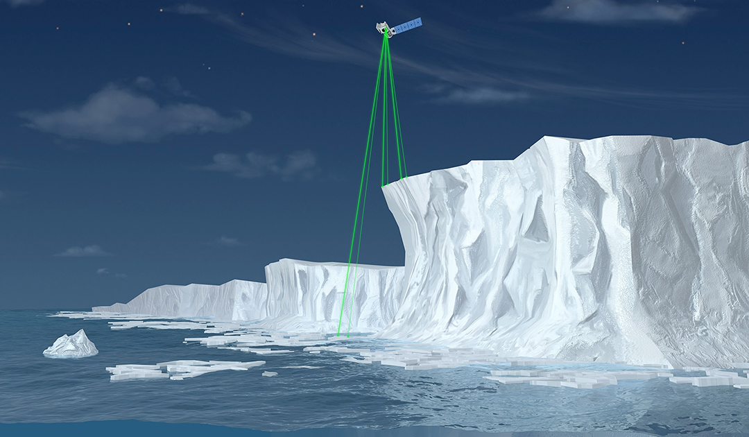
The accuracy of the measurements through the use of six lasers combined into three bundles is also enormous. The positions of the lasers on the satellite, the laser pulse rate and the speed of the satellite allow one measurement per 70 centimeters of ground within a radius of 17 meters per pulse. This gives research teams unprecedented resolution. “The level of detail we can get from ICESat-2 is something we’ve never achieved from another satellite. It’s a game changer.,” says Dr. Sinéad Farrell of the University of Maryland, who works in the meltwater pond field.
The technology on board the satellite and the ATLAS system not only allows to look at the surface of sea ice, glaciers and ice sheets, but also to discover large-scale subglacial lakes deep beneath the Antarctic ice sheet. The extent to which meltwater ponds actually affect the surface of ice sheets and glaciers in Greenland and Antarctica is also based on ICESat-2 data. Other research teams are combining ICESaT-2 measurements with those from ESA’s CryoSat-2 satellite, which provides data on snow amounts on sea ice, to provide a more detailed picture of what is happening on Arctic sea ice.
And it is not only in the polar regions that ICESat-2’s measurements help; the data are also a great help in the areas in between. For example, researchers have been able to study changes in coral reefs in the Pacific or coastal areas in North America. Seemingly, there is little limit to what can be done with the data ICESat-2 provides. “I’m looking forward to the tsunami of studies coming,” says Alex Gardner.
Dr. Michael Wenger, PolarJournal
More on the subject


