
When Amundsen set out on his expedition toward the geographic South Pole in 1911, he knew he had started a race. His opponent at the time was Sir Robert Falcon Scott, who learned late of Amundsen’s intention. The story ends with the victory of Amundsen, who reached the southernmost point of the Earth on December 14, 1911, and Scott’s defeat and death. 111 years after that race, two icebreakers are now also involved in an unofficial race to the southernmost point ships can reach.
On one side is the U.S. icebreaker “Polar Star,” which is reported to have reached position 78° 44.022′ in the Bay of Whales on February 17, 2022, during surveys of the bay. This was reported by various ship-related websites on March 1, 2022. Those on board the “Polar Star” also report that they have sent the position to the Guinness Book of Records for verification and entry.
On the other side is the latest built passenger icebreaker “Le Commandant Charcot” of French company Ponant. It is said to have reached a position of 78° 44,300′ on February 27, 2022. Images of this were recently shared on social media channels, showing the ship close to the Ross Ice Shelf. PolarJournal inquired directly with the image owners, as nothing had been reported on Ponant’s official sites. A response in this regard is still pending at the time of publication of this article. Therefore, it is not yet clear whether the achievement of the French icebreaker has also been sent to the Guinness Book.
Moreover, according to their data, the difference between the two ships is just 0.008 minutes. Since this is only a small difference in distance, numerous factors have to be taken into account to calculate the exact position – a photo finish, so to speak.
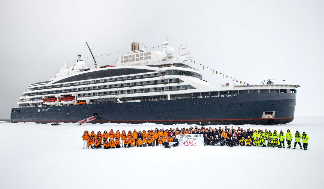
The French icebreaker “Le Commandant Charcot” also took advantage of the currently low pack ice extent and entered the Bay of Whales. The ship, which is sailing in Antarctica for the first time, is on an expedition voyage that included the Ross Sea as one of its destinations. On the way, Captain Patrick Marchesseau and his crew already announced that they had reached the southernmost point of any French ship ever. In addition, the icebreaker was able to assist the British research icebreaker “Sir David Attenborough” in a logistical voyage and helped transport material to the research group at Thwaites Glacier, as reported by the British Antarctic Survey. If the performance of the ship and its crew is indeed confirmed by Guinness, the icebreaker would become not only the most southerly French ship or passenger vessel, but the world record holder for the most southerly point reached by a ship. Currently, this title is held by the luxury expedition ship “The World”, which had sailed at 78° 43.997′ in 2017.
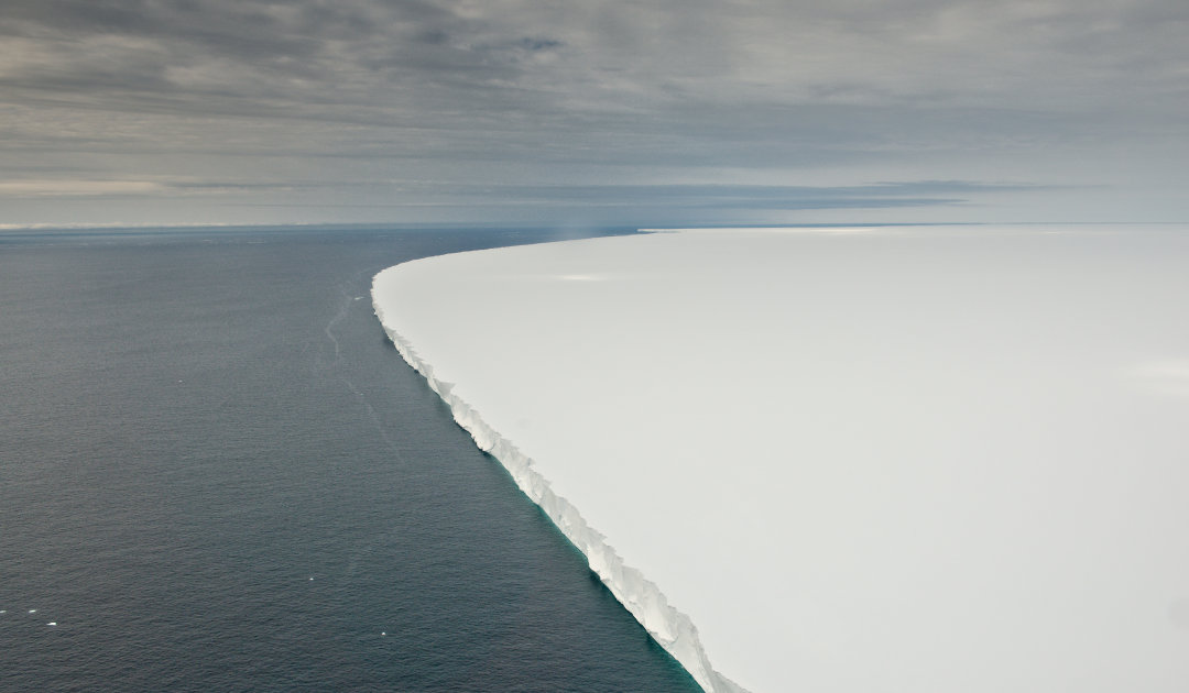

Both ships were able to benefit this season from the fact that the pack ice in the Ross Sea has a particularly low extent this year. In fact, never since records had started has so little ice been recorded in the area, as various institutions had reported. This freed up areas near the Ross ice shelf for scientific studies of the seabed. The USA had sent the “Polar Star” to survey the previously uncharted area. According to official data, it was possible to map about 740 kilometers of the seafloor, an important aspect for future cruises along the ice shelf, which is after all about 525,000 square kilometers and thus almost the size of France. The effects of global warming have also been studied here for years. This is also the downside of the achievement: reaching this position has only been possible due to massive shrinkage of both the pack ice and the breaking off of huge tabular icebergs on the ice shelf.
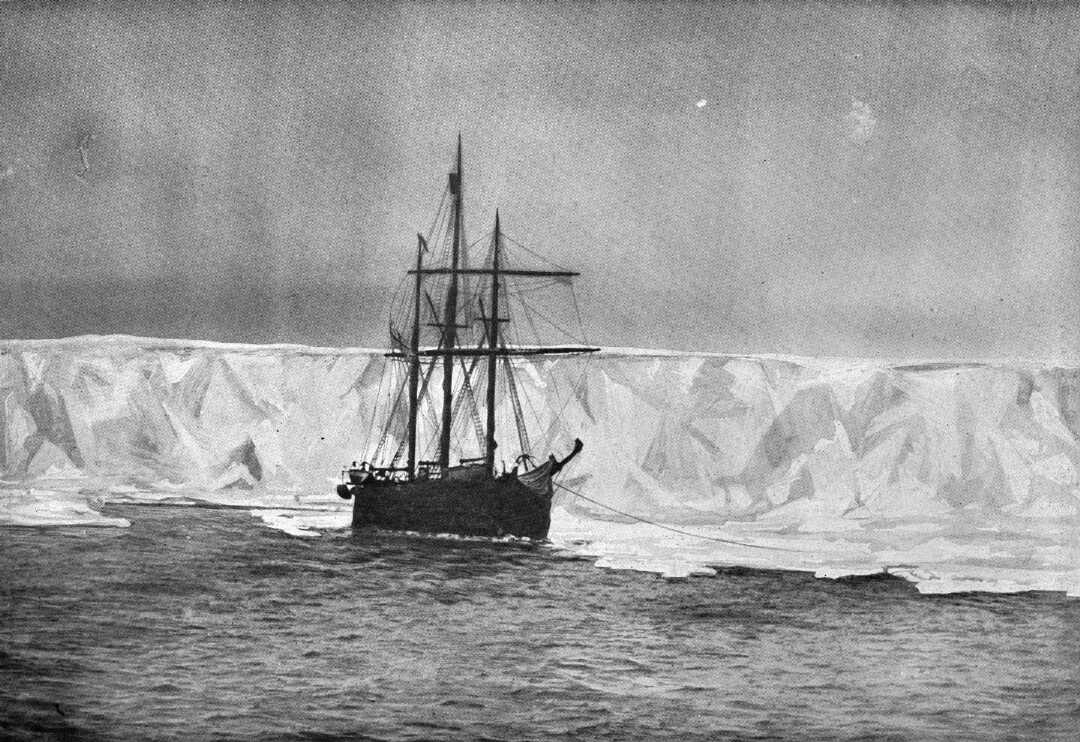
The Bay of Whales is a popular spot along the Ross Ice Shelf to get deeper into the Ross Sea and thus closer to the Antarctic mainland. The bay was first described in detail by Sir Ernest Shackleton in 1908 and so named because he had discovered numerous whales here. Less than three years later, Roald Amundsen recognized the strategic importance of the bay on his way to the geographic South Pole. He anchored his ship “Fram” in the bay to start his expedition from here and thus give the starting signal for a race that in the end left a beaming winner on the one hand and a shocked nation on the other. Fortunately, the current “race” is not decided this way, but by some experts in an office. And no matter who ends up listed in the Guinness Book as the record holder, for the parties involved who were so close to the edge of Antarctica, the moment will remain unforgettable.
Dr Michael Wenger, PolarJournal
More on the subject:


