

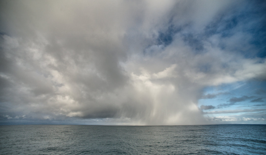
In the discussion about climate change, it is often argued that warming is probably not really happening. As so-called proof, the proponents of this statement cite the larger amounts of snow in large parts of northern Europe and northern Asia. But a study from Japan now reveals the real reasons why snow crystals are falling from the sky in huge quantities in the Nordic regions and parts of Siberia.
More moisture in the atmosphere due to the melting of polar ice sheets, sea ice sheets and the glaciers around the world leads to more precipitation in other regions. Apparently, the northern parts of Europe are among the areas that have actually received more snow in recent years. Research by Tomonori Sato of Hokkaido University and his team found that evaporation of water over the Barents and Kara Sea region in the west and the Chukchi and East Siberian Seas in the east has been highest between October and December over the past 55 years. This moisture was then transported south by changing air currents and fell in the form of large amounts of snow in northern Europe and parts of Siberia. The work was published in the journal npj climate and atmospheric science.
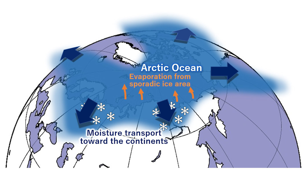
Tomonori Sato, who is an assistant professor at Hokkaido University’s Department of Environmental and Earth Sciences, and his team examined historical global weather data from the past 55 years and incorporated it into an existing model to analyze moisture transport pathways. From the results of the model calculations, Sato and his colleagues were able to determine the point of origin and timing of the largest amounts of moisture. A comparison with sea ice data and weather data showed that between October and December, when sea ice cover is lowest and the Arctic Ocean is warmest, the greatest amounts of moisture are transported into the atmosphere. When the moist air masses are then transported southward with the low-pressure systems, they fall as snow over the cooling land masses. It is important to understand that both the freezing of water masses has become increasingly delayed as well as the strength and frequency of low pressure areas over the study periods. This allows more moisture to enter the atmosphere, which then falls again as snow in northern Eurasian regions.

The results of the study by Tomonori Sato and his colleagues show that the weather in the Arctic has indeed changed in recent decades, and that warming of the region has been a major factor in this. All expert forecasts predict that this trend will continue, including further snowfall in northern Eurasia. Sato and the author team share this view. But they write in their paper that the results of their study could help improve forecasts of weather anomalies in the regions. The winter snowpack anomaly may be of particular importance as a precursor signal to potential heat waves and the resulting tundra fires. That’s because snowfall “often delays the downstream effects of the weather events that cause it.” Thus, authorities and experts would at least have a kind of crystal ball, consisting of snow crystals.
Dr Michael Wenger, PolarJournal
Contributed image: (C) Annina Egli
More on the topic


