
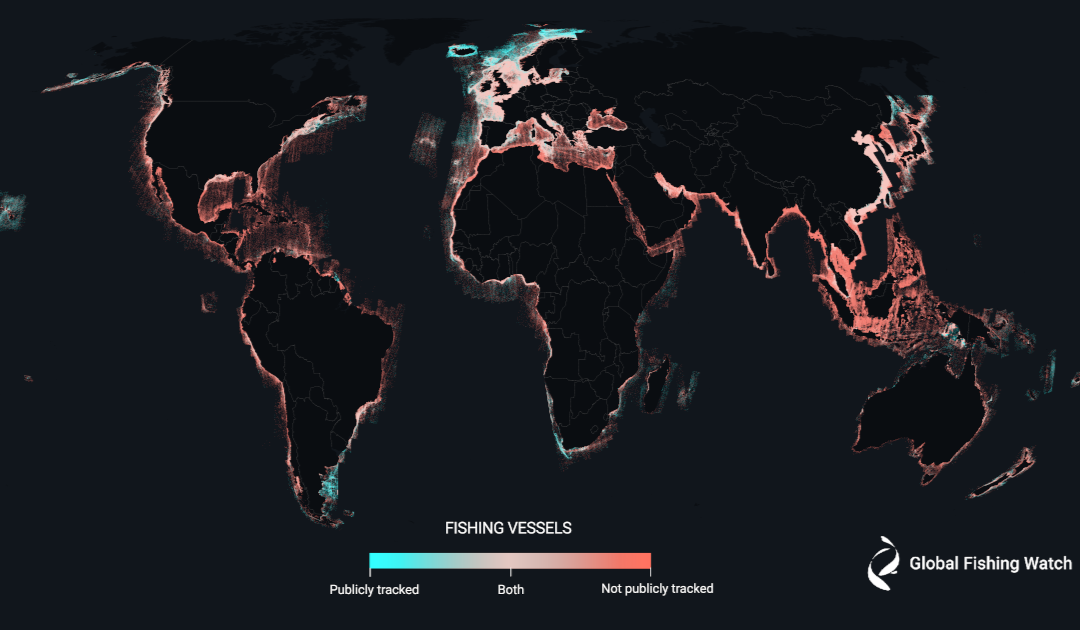
An unprecedented study reveals the best-ever estimate of the distribution of industrialized fishing. Although the poles are popular fishing grounds for certain species, they are also monitored in very different ways. While the Arctic is fairly well managed, observation of the Antarctic suffers from observation difficulties.
Three quarters of sea fishing is not made public, i.e. vessels do not share their navigation data or are not captured by monitoring systems, and around a third of maritime activity linked to transport and energy is not made public either. This is shown by the study published on January 3 in Nature by Global Fishing Watch, a non-profit organization launched by Google in 2015, then made autonomous in 2017. She is working on the accessibility of global fisheries data.
“Ten years ago, we had no idea of the distribution of the world’s fisheries in international waters, and we were very surprised to discover the extent of this missing activity: 75%”, comments David Kroodsma, Director of Research and Innovation at Global Fishing Watch.
Back to the method
The researchers inventoried the routes of ships between 2017 and 2021 – those that openly share their navigation data via AIS and VMS transponders. They then trained an artificial intelligence to recognize maritime activity from satellite images.
“We had already produced a 1st fishing map using AIS data, but we knew that part of the puzzle was missing,” explains Fernando Paolo, artificial intelligence engineer at Global Fishing Watch. “So we developed a technology capable of filling this gap. The big advantage of radar images is that they are not limited by clouds or lack of sunlight to detect objects on the ocean.”
The researchers then trained artificial intelligence to recognise fishing vessels. “We take into account the environment, the depth, the traffic, the temperature, the chlorophyll, the size of the vessel… Fishermen follow fish, they follow bathymetric lines for example”, adds Fernando Paolo.
And the polar regions?
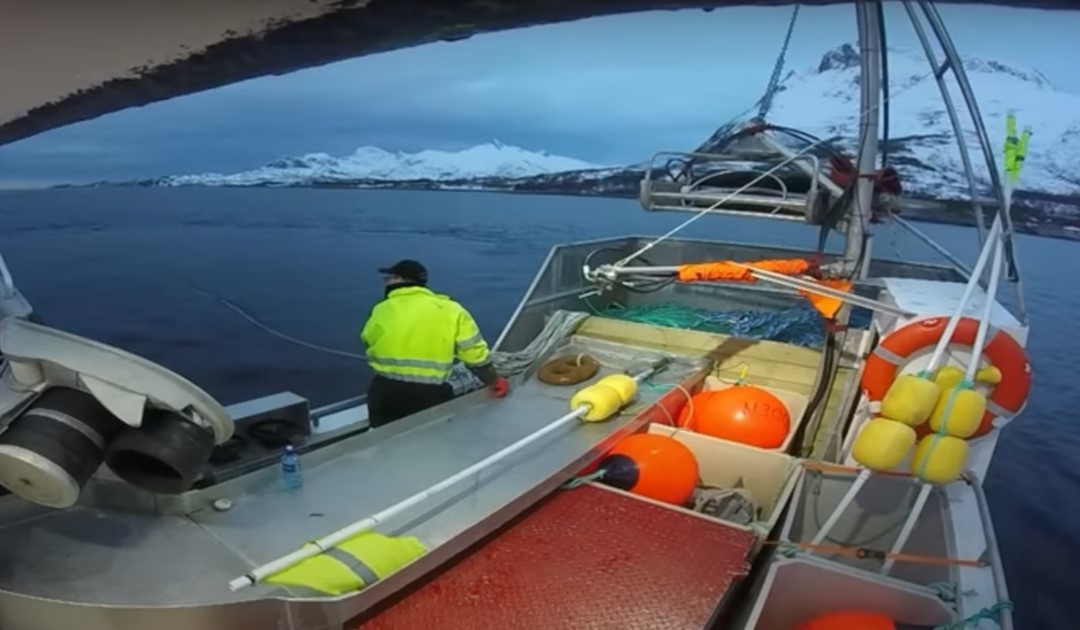
The Arctic is the maritime area where ships share the most navigation data. In Norway, more than 75% of maritime activities are publicly known, compared with a 100% absence of activity data in the Bay of Bengal.
“One of the most fascinating things about the world fisheries map is how little fishing there is in the Arctic compared with other parts of the world. Most of them share their navigation data, mainly because there are developed countries and big boats there,” observes David Kroodsma.
What do these 75% represent? The Norwegian Arctic is home to one of the world’s largest cod fisheries, which coexists with other industrial fisheries. “”Most of these are inshore vessels fishing with conventional gear, with most trawling taking place outside the 12 nautical mile limit. There are also major pelagic fisheries,” explains Alf Håkon Hoelt, a researcher in ocean law and governance at the Arctic University of Norway in Tromsø.
The Global Fishing Watch study points out that one billion people depend directly on the sea for their food, and this also applies to the Arctic. “Compared to other regions at the same latitude, the area is densely populated. Fishing and aquaculture are the mainstays of regional and local economies along this coast”, adds Alf Håkon Hoelt.
The remaining 25% are not necessarily illegal activities in Norway. Most of the activities not listed are in the fjords. “This figure does not reflect industrial fishing in the area, which is also well monitored,” adds Fernando Paolo.
A regulation had not yet come into force at the time of the observations. “Until 2021, vessels less than 15 meters long were not required to be equipped with a VMS system,” says Alf Håkon Hoelt, adding that “Norway has a large fleet of small vessels, 4,000 to 5,000 of which are less than 11 meters long.”
“As far as the Russian cod is concerned, it’s difficult to get information on undeclared activities,” notes Hervé Baudu, an expert in polar navigation at the École Nationale de Marine Marchande. At this level, the Global Fishing Watch project is limited in its observations.
Iceberg or ship?
“Another challenge in the polar regions is the high concentration of icebergs, which can confuse the detection of ships,” explains Fernando Paolo.
The project aims to improve its observations in regions where the sea is icy and where there are icebergs. The project aims to map all human activities on the surface of the oceans.
In this respect, Unseenlabs’ technology, based on ship electromagnetism, would be of incredible value to Global Fishing Watch, “especially in the Arctic, where radars have difficulty telling whether it’s an iceberg or not,” explains David Kroodsma. Here, the radio frequencies are very clear.”
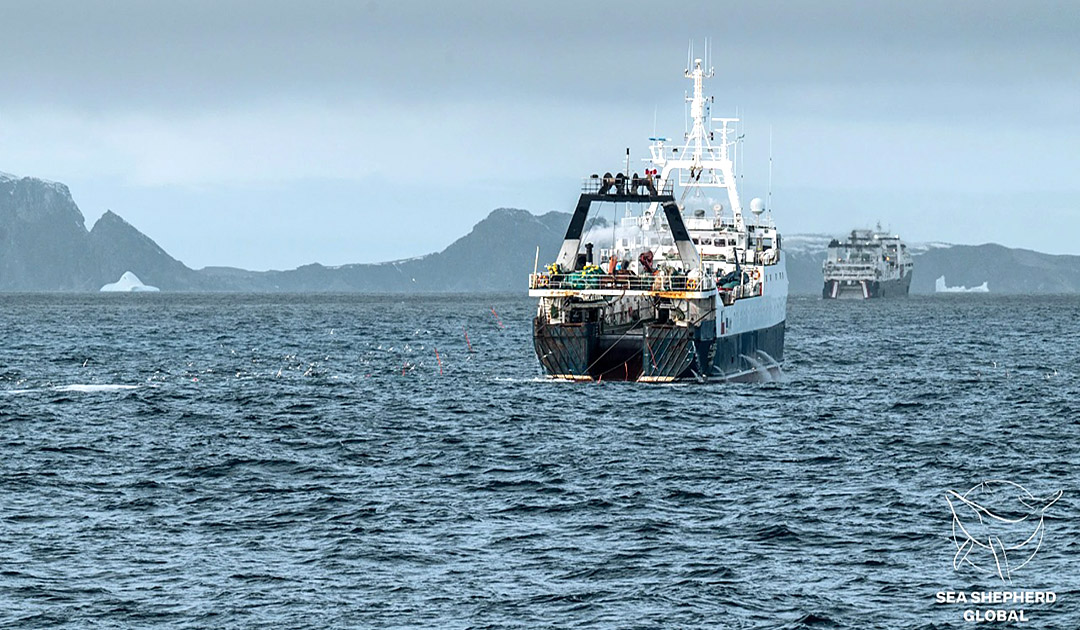

Making progress in the polar regions could be a major step forward for fisheries monitoring and management. In the Southern Ocean, krill, Patagonian toothfish and lanternfish form coveted biomass concentrations. Illegal fishing operations have already been thwarted in the French Southern and Antarctic Territories, thanks to military surveillance and technology carried on the backs of giant albatrosses. But this observation pressure is small compared with the sheer size of the ocean.
Another challenge faced by Global Fishing Watch is the limited coverage of satellite imagery in the Antarctic region. According to Cannelle Gaucher of Unseenlabs: “Unseenlabs’ satellites pass over the polar regions”.
Global Fishing Watch estimates that the proportion of stocks managed sustainably represents a third of the fisheries observed. “We need more transparency in maritime activity, and this new data shows where the needs are. Today, we are able to identify vessels that do not report their activity, find out their size and estimate whether they are fishing boats”, concludes David Kroodsma.
Camille Lin, PolarJournal
Learn more about this topic:


